Drone Mapping
Aerial mapping flights and visual documentation that turn a site into clear, shareable data.
Detroit drone services and design services: drone mapping, 3D, aerial imagery, and design across Metro Detroit and Michigan.
A full stack of drone, 3D, and design services, delivered with the polish of a technology team and the clarity of a design studio.
Aerial mapping flights and visual documentation that turn a site into clear, shareable data.
Repeatable aerial documentation to track progress, stakeholders, and timelines on a job site.
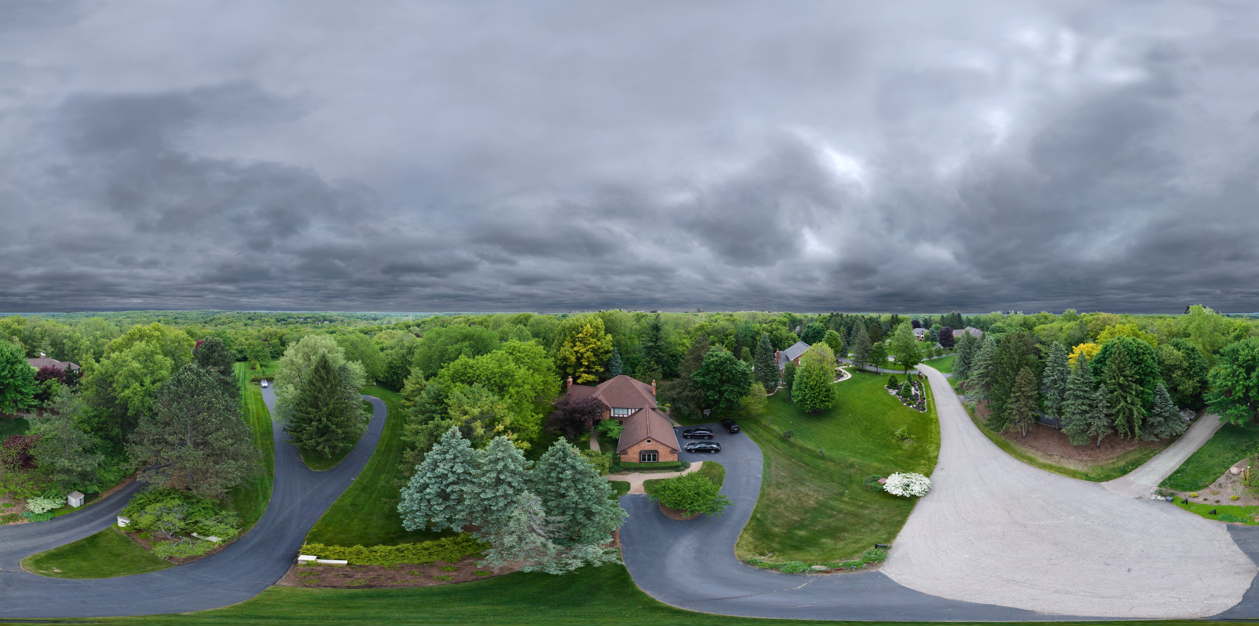
High resolution aerial imagery and video that show property, land, and surroundings at their best.
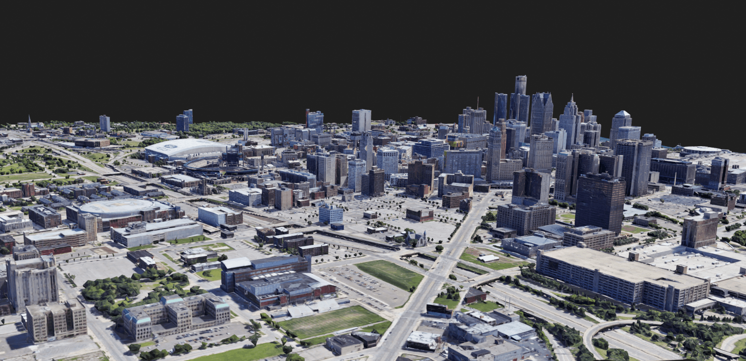
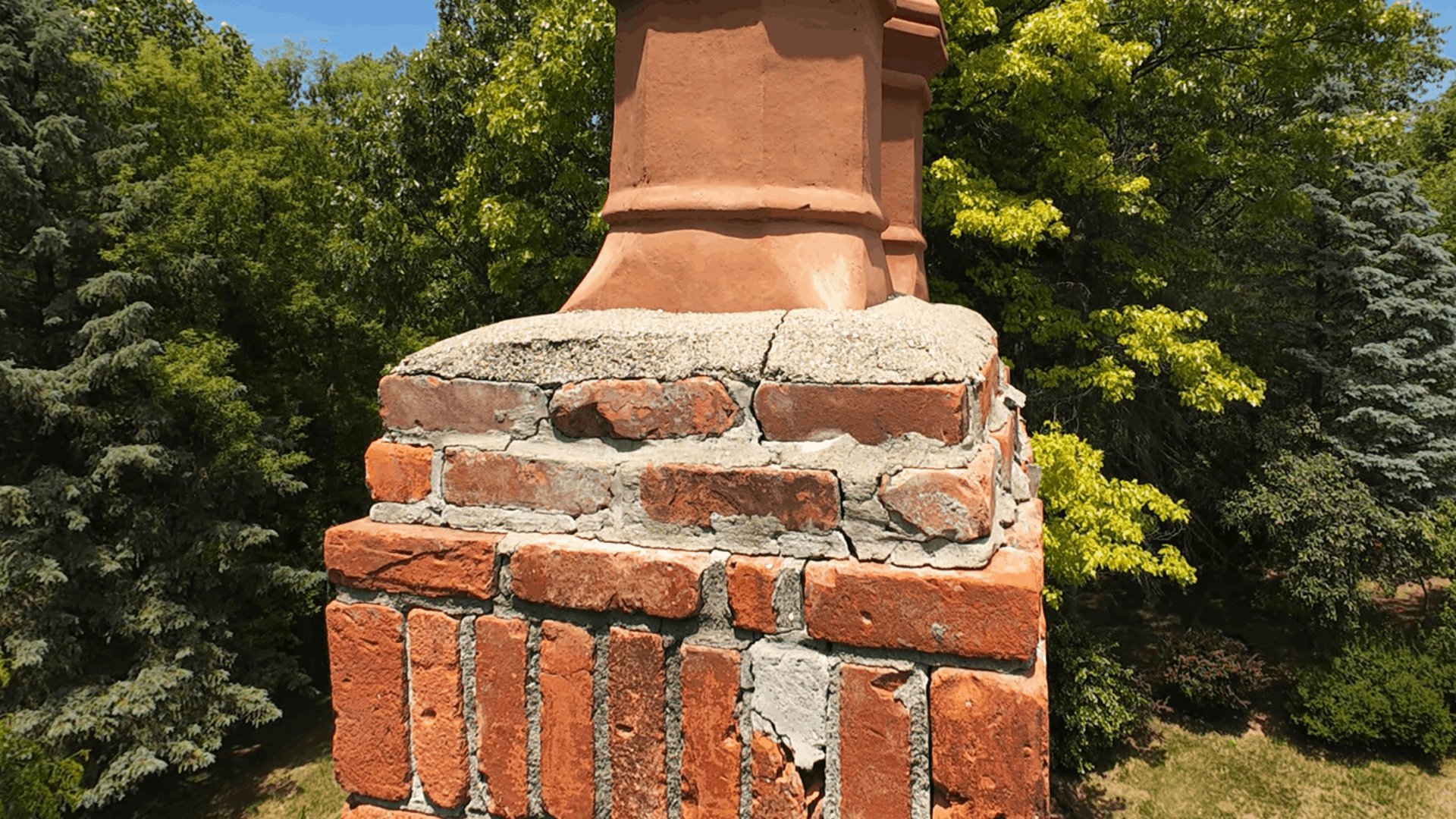
Photo based 3D reconstruction of structures, sites, and objects for visualization and review.
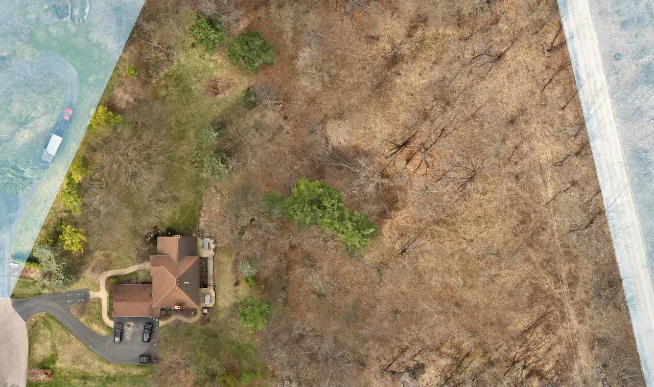
Stitched orthomosaic maps and mapping deliverables formatted for your team’s workflow.
Embeddable, explorable 3D models and interactive media for the web, with no special software needed.
User focused interface and product design that makes technical tools clear and approachable.
Turning complex spatial and technical data into visuals people can actually understand.
A look at the kinds of drone, mapping, 3D, and design work DET3D delivers. Replace these placeholders with your own projects.
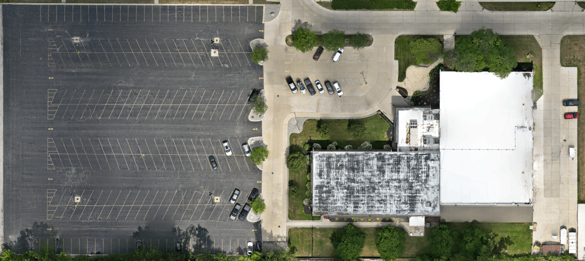
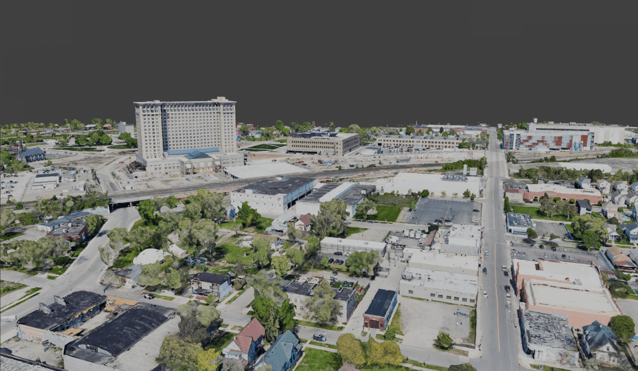
Drone mapping and orthomosaic deliverables documenting a large parcel for planning and review.
View project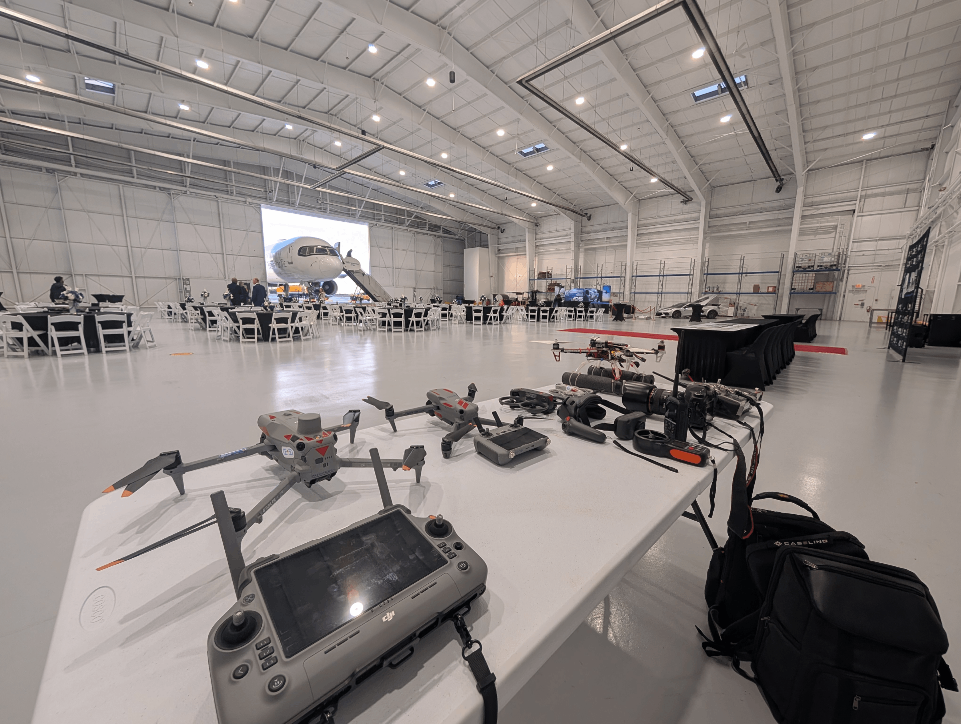
Repeatable aerial documentation across a months long build timeline.
View project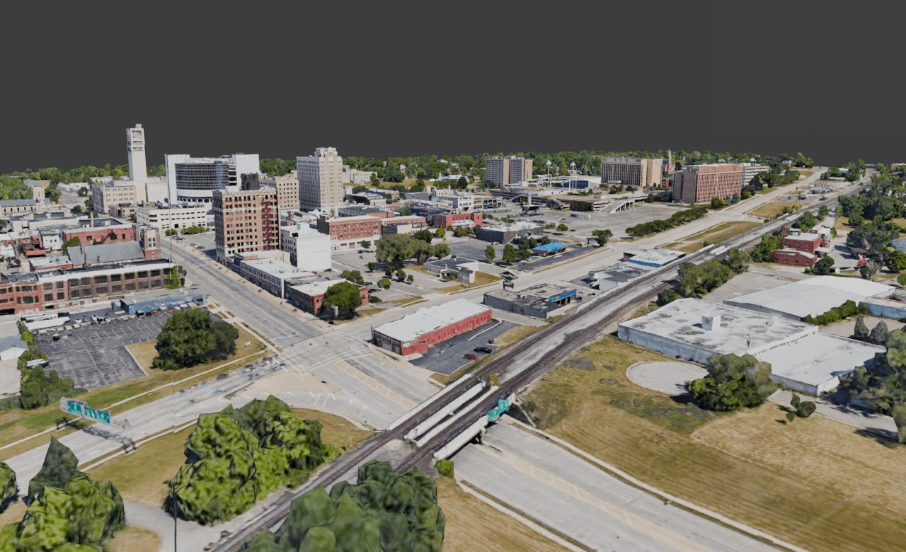
Photogrammetry reconstruction delivered as an explorable web experience.
View project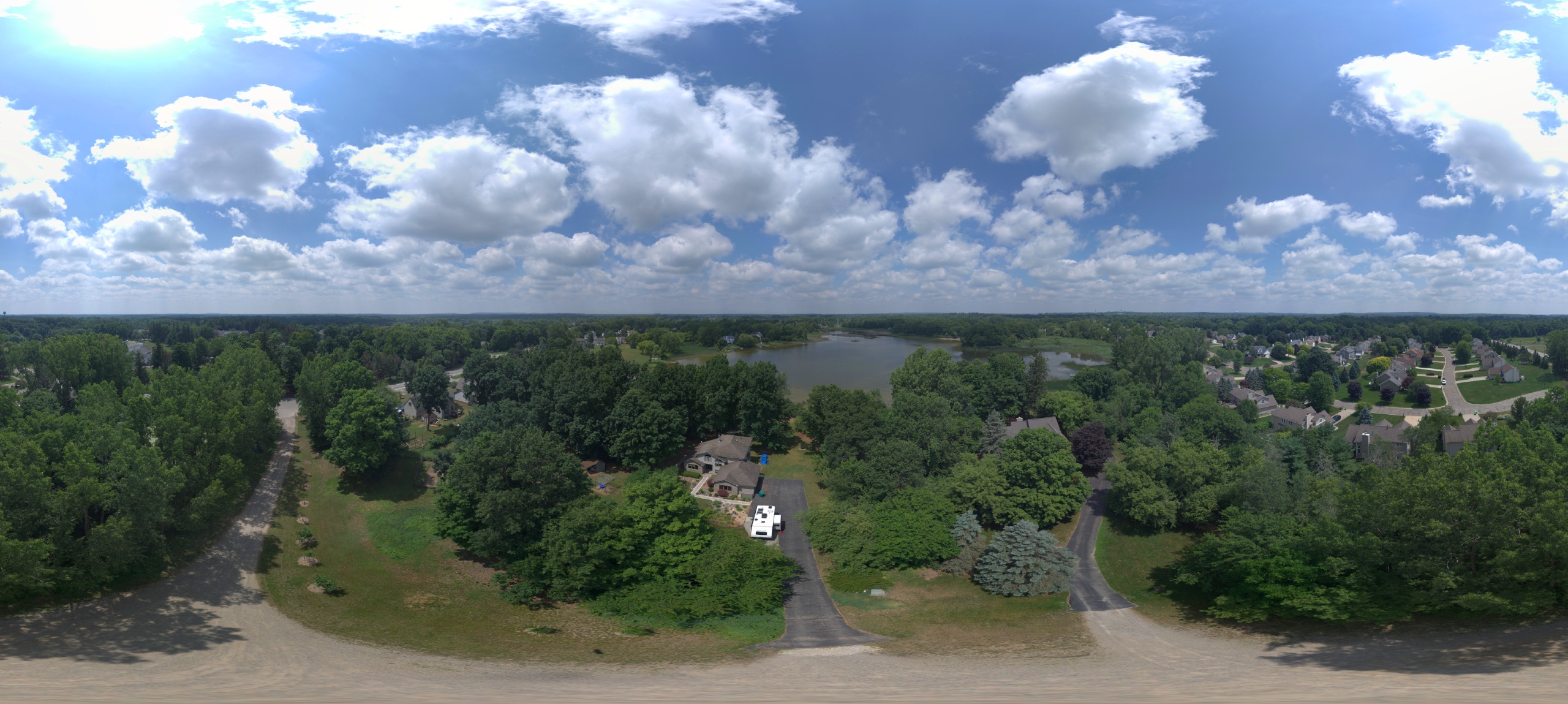
High resolution aerial imagery and video for a property listing.
View projectClear steps from first conversation to final delivery, with no jargon required.
We learn your goals, site, deliverables, timeline, and what success looks like for you.
We scope the right capture and design approach, and map out the deliverables you need.
We collect aerial and visual data, or design the interface and experience around it.
Imagery becomes maps, 3D models, and visualizations, reviewed for quality and clarity.
You receive organized, easy to use deliverables in the formats your team works with.
We stay available for follow up captures, revisions, and ongoing project needs.
DET3D works with organizations across Metro Detroit and Michigan. We bring a technology forward, design driven approach to drone, mapping, and 3D work, with technical capability and visuals people enjoy using.
Quick answers about DET3D drone, mapping, 3D, and design services in Metro Detroit and Michigan.
DET3D offers drone mapping and visual documentation, high resolution aerial imagery and video, 3D photogrammetry, orthomosaic mapping deliverables, interactive 3D experiences, and UX and product design services.
Yes. DET3D is available for drone mapping and visual documentation projects across Metro Detroit and Michigan.
Yes. Repeatable aerial imagery is a practical way to document construction progress over time and share clear visual updates with stakeholders.
Yes. DET3D produces 3D models through photogrammetry and can deliver orthomosaic maps and related mapping deliverables formatted for your workflow.
Yes. Alongside drone and 3D work, DET3D offers interactive 3D web experiences and UX/UI and product design services to make technical content clear and engaging.
Tell us about your project and we’ll recommend the right mix of drone, 3D, and design services. Available for projects across Metro Detroit and Michigan.